CLAS PPP below 10 cm without a base station
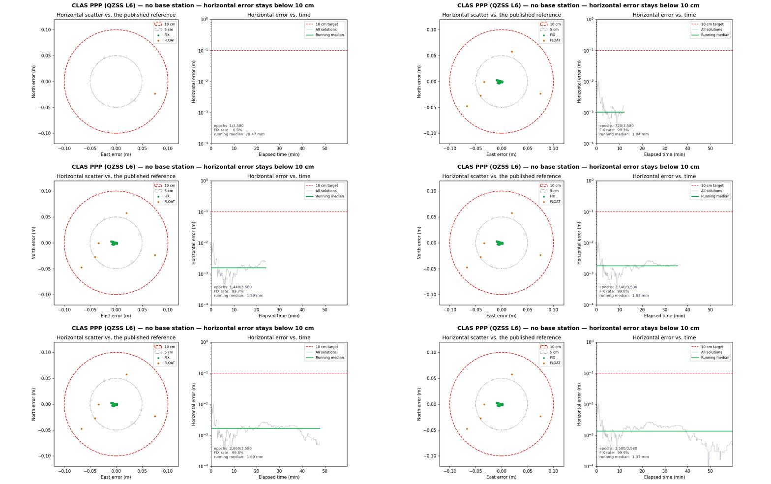
This page is a single, self-contained demonstration that carrier-phase PPP can reach centimetre-level positioning with no local base station: the corrections arrive over the QZSS L6 signal (CLAS), and the only rover inputs are its own observations plus broadcast navigation.
The animation scores the solution against the published antenna reference and keeps a hard 10 cm circle and a 10 cm error line on screen. Every epoch stays inside the circle.
What was run
| Item | Value |
|---|---|
| Dataset | Public QZSS-Strategy-Office/claslib 2019-08-27 sample |
| Inputs | 0627239Q.obs, sept_2019239.nav, 2019239Q.l6 |
| Base station | none (CLAS corrections over QZSS L6) |
| Window | 2019-08-27 16:00:00 GPST, 3580 one-second epochs |
| Solver | CLASLIB reference rnx2rtkp (util/rnx2rtkp/static.conf) |
| Reference | published antenna ECEF (-3957235.3717, 3310368.2257, 3737529.7179) |
The reference ECEF is the value recorded in
CLAS public validation datasets. The RINEX
header APPROX POSITION XYZ is deliberately not used as truth.
Result
| Population | Epochs | Median horizontal | P95 horizontal | Max horizontal |
|---|---|---|---|---|
| FIX (NMEA quality 4) | 3575 | 1.37 mm | 2.53 mm | 10.2 mm |
| FLOAT (NMEA quality 5) | 5 | 60.9 mm | 81.3 mm | 82.1 mm |
| All | 3580 | 1.37 mm | 2.53 mm | 82.1 mm |
100% of FIX epochs and 100% of all epochs are below 10 cm; the worst error in the entire run is 8.2 cm. The FIX solution is a static point with a median horizontal error of 1.37 mm, which is the classic CLAS PPP result on this public sample.
The same numbers are written to
docs/clas_ppp_no_base_accuracy.json.
Reproduce
The generator fetches the pinned public sample, runs the reference solver, and renders the GIF:
python3 scripts/experiments/claslib/generate_clas_ppp_accuracy_gif.py
Useful options:
# reuse an existing CLASLIB checkout instead of fetching
python3 scripts/experiments/claslib/generate_clas_ppp_accuracy_gif.py \
  --claslib-root /path/to/claslib

# re-render from an existing NMEA GGA solution (no solver run)
python3 scripts/experiments/claslib/generate_clas_ppp_accuracy_gif.py \
  --nmea /path/to/claslib.nmea
The script pins the CLASLIB data/source to
23cfd363a2db6d8d8144e292c82e9d97ca2d3015 for a reproducible fetch and uses the
prebuilt Windows rnx2rtkp.exe or builds util/rnx2rtkp with make on other
platforms.
Boundary
- This is a static, open-sky, Japan-only L6 capture; it is not a moving or urban-availability result. Moving CLAS behaviour and FIX rates are documented in CLAS sub-meter fleet tracking.
- The capability proof uses the public CLASLIB reference solver. The native
libgnss++CLAS-OSR path is still tracking the same sample and does not yet match the reference trajectory (see the CLASLIB parity baselines); this page does not claim native parity. - It is a capability demonstration, not a survey certification.